|
Water
[A]ll up and down the Middle Rio Grande Valley more than seven hundred fifty million people depend on a diminishing underground water source. Sand, gravel, and clay hold deep, ancient waters that are minimally replenished by the high desert's infrequent rains and snows, by seepage from unlined irrigation canals, and by the river itself. The Rio Jemez empties into the Rio Grande, along with the water of the Rio Salado, near Bernalillo. Underground waters are what 90 percent of New Mexicans drink. And for its entire life as a city prior to 2008, Albuquerque has supplied its residents with nothing but pure water from that aquifer. In the last twenty-five years, however, it's become increasingly evident to water managers and conservationists all over the state, especially in Albuquerque, that there's more paper water than real water in New Mexico. The New Mexico state engineer, who oversees state water, made it clear in 2006 that "the state's surface water supply and most of the groundwater supply is fully or over appropriated. If all the water right permits, licenses, and declarations were fully exercised today, the current supply would not likely meet the demand" (p. 55).
- [I]n March 2007 the World Wide Fund for Nature placed the Rio Grande on its list of the ten most endangered rivers in the world, most notably its southern reaches, separating Texas from Mexico (p. 270).

 |
|
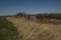
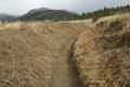
Tumbleweeds pile up along the Pecos River near an abandoned field. Dexter. March 2007. |
 |
|
Peralta Ditch, the acequia madre, Tomé. March 2007. 1 |
 |
|
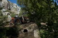
View of land being plowed near Tomé, an irrigation ditch in the foreground. March 2007. |
 |
|
Flood irrigation in Tomé. Upon the first watering of the season, a farmer notes the high spots in the land and shunts the water to those areas when he or she floods again. May 2007. |
 |
|
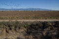
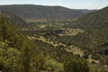
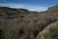
Looking down from the road at the Valley of San Agustin, which lies southeast of Las Vegas. In the middle it is greener due to irrigation from the Gallinas River. May 2008. 2 |
 |
|
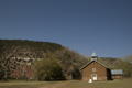
San Agustin church. April 2008. |
 |
|
In the village of San Agustin there are seven active ditch members; they water alfalfa, garden orchards and livestock, but none live in the community full time anymore. May 2008. |
 |
|
William and Ginny's house in San Agustin. April 2008. |
 |
|
It is not uncommon to see road signs used for water control in the acequias; here William uses one of his old campaign signs. April 2008. |
 |
|
William on his “new” tractor attempting to fix a leak between two segments of culvert under a dirt bridge over the ditch. May 2008. |
 |
|
William Gonzales and Ginny Johnson in their blossoming orchard in the Valley of San Agustin. The village church can be seen across their garden. April 2008. |
 |
|
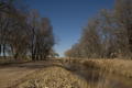
The Rio Grande at the end of Old Buckman Road outside Santa Fe. February 2007. 3 |
 |
|
Booster pump station at the Buckman well field outside Santa Fe. February 2007. |
 |
|
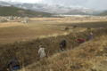
On Ditch Day in Guadalupita, near Mora, community members clear the acequias of winter debris to prepare for spring irrigation. March 2009. |
 |
|
Moments before the water is let flow for the first time of the season on Ditch Day. Guadalupita. March 2009. |
 |
|
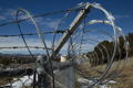
A cement-lined acequia on Zia Pueblo before spring cleaning. February 2007. 4 |
 |
|
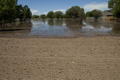
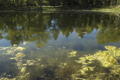
Pond created from seepage from irrigation ditches on a residential property that was formerly a commercial nursery. Las Vegas. May 2008. |
 |
|
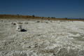
Dead carp at McAllister Lake near Las Vegas. November 2007. |
Notes:
[1] Agrarian values in the north are embodied in acequia culture, both the political and social entities of acequia communities and the irrigation systems themselves. Some one thousand organized acequias still exist in New Mexico…. “Although acequia associations have strong legal claims to the water they need for agriculture, they are under increasing pressure to sell their water rights to commercial developers” (quote from David J. Groenfeldt of the Santa Fe Watershed Association) (p. 289).
[2] Las Vegas…has suffered a serious water shutdown since the mid-1990s. Some years, like 2006, Las Vegas had to go to a Stage 3 water alert, in which all outdoor watering was forbidden…. To protect the rights of downstream users, Las Vegas can draw only twenty-six hundred acre-feet a year from its primary water source, the Gallinas River, according to a 2005 decision by the New Mexico Supreme Court. Any additional water must come from its reservoir at Storey Lake, which itself has been severely depleted by drought (p. 89).
[3] The aquifer that Santa Fe's Buckman well taps into has been the object of intense scrutiny and concern; its watershed on the Pajarito Plateau is dominated by LANL [Los Alamos National Laboratories], with its more than twenty-one hundred waste sites and its record of dumping industrial and radioactive waste into canyons that drain into the Buckman aquifer and the Rio Grande (p. 268).
The LAHDRA report [Los Alamos Historic Document Retrieval and Assessment, a report by the CDC] confirms that “liquid radioactive waste was discharged to Acid-Pueblo Canyon without treatment or monitoring from 1945 through 1950.” But there wasn't a year from 1945 until 1996, and perhaps beyond, that plutonium, strontium-90, and other forms of radioactivity weren't released into the waterways of the canyons coming off the Pajarito Plateau and leading to the Rio Grande (p. 301).
[4] The Pueblo of Zia, as of this writing, had filed a protest blocking Rio Rancho's water grab, claiming its agreement with the other farming communities has legal authority. If Rio Rancho wins this dispute and buys the agricultural water rights, irrigation along the Rio Jemez will be diminished, with potentially disastrous results to Zia, which needs the current full flow of the river for farming (p. 67).
|
|